2027 Season Bookings Now Open!
Popular Trail

Mt. Dewey Trail

Nature • Scenic • Vistas
Popular Trail Overview

A Glimpse of the Attraction

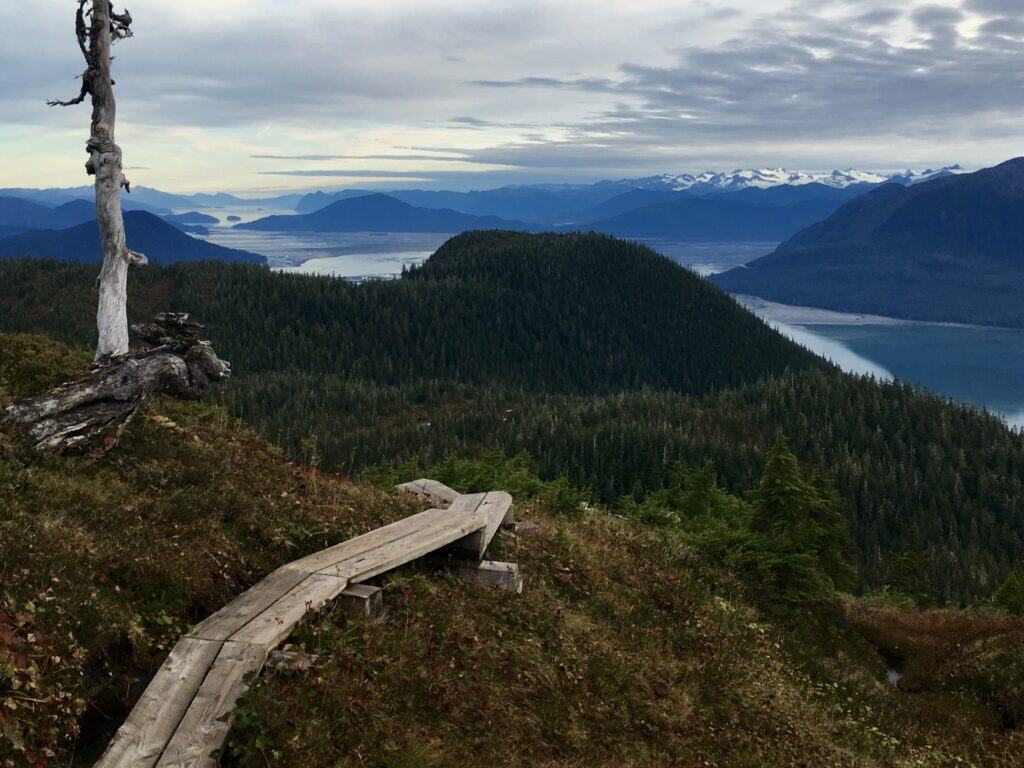
Ascend through temperate rainforest along stepped timber boardwalks to a high observation platform overlooking Wrangell Harbor and Zimovia Strait. A rewarding, short-climb summit hike made famous by naturalist John Muir in 1879.

Perfect For...

• Panoramic view seekers • Fast summit workouts • John Muir historians

Not the Best Fit For...

• Stroller or wheelchair users • Severe knee limitations • Extended multi-mile treks

Top Highlights

  • 180-Degree Harbor Lookout: Elevated timber observation deck with sweeping vistas of Zimovia Strait and outer islands.
  • John Muir Historic Connection: Commemorates the famous 1879 night ascent and mountaintop bonfire by the legendary naturalist.
  • Downtown Rainforest Corridor: Immediate transition from downtown streets into mature old-growth Sitka spruce canopy.
  • Quick High-Reward Hike: Gain 260 vertical feet and summit views in a compact 30-to-45-minute round-trip outing.

Deep Dive

The Attraction

The Mount Dewey Trail is Wrangell’s quintessential town-summit hike, combining rainforest ecology, local history, and panoramic coastal views within a compact 45-minute round-trip excursion. Rising directly behind the historic downtown street grid, the trail quickly leaves the sounds of town behind, immersing hikers in an old-growth canopy of mature Sitka spruce, western hemlock, and lush devil’s club thickets.

The trail is famous for its direct connection to pioneering naturalist John Muir. In October 1879, during his historic explorations of Southeast Alaska with Presbyterian missionary S. Hall Young, Muir set out after dark during a stormy evening to climb to the top of Mount Dewey. Upon reaching the rocky crest, Muir constructed an enormous bonfire using resin-rich yellow cedar snags, illuminating the surrounding mountains and shocking the local residents and miners below in town. Interpretive signage along the route commemorates Muir’s nocturnal ascent and his writings describing the dramatic archipelago landscape.

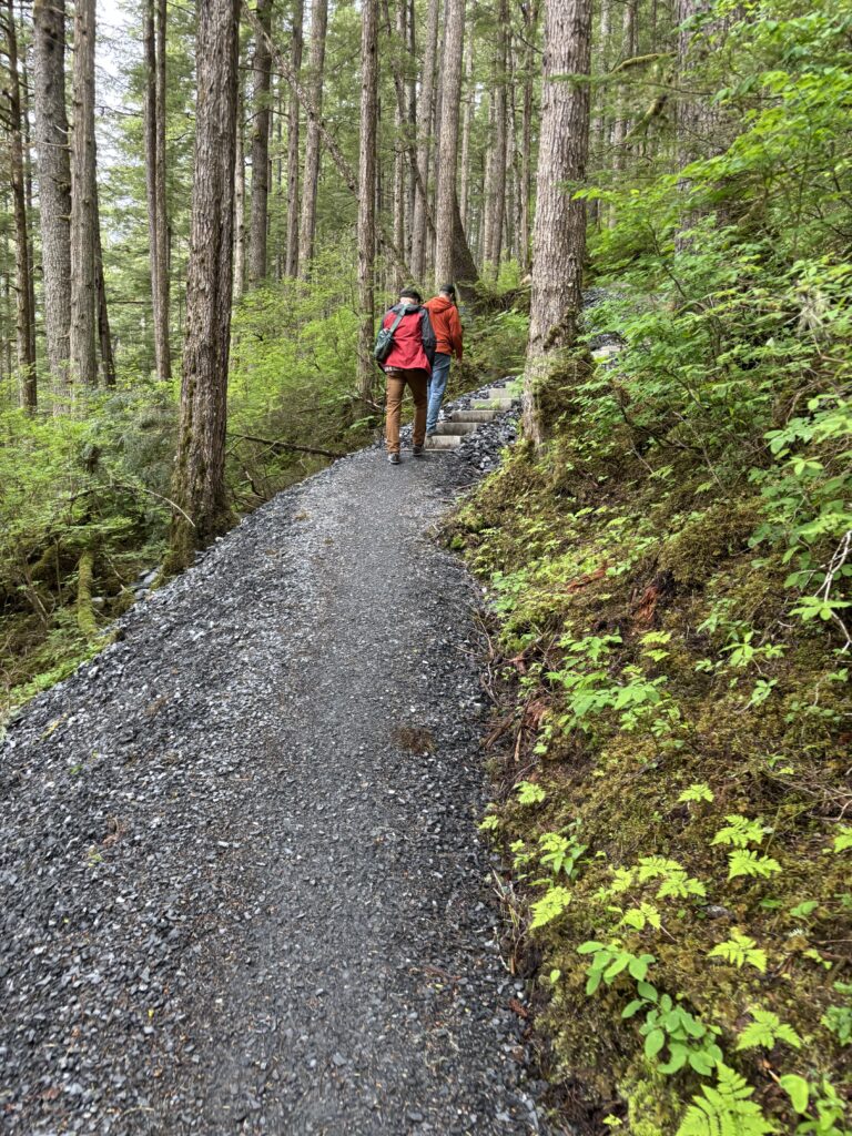
Modern hikers climb a series of well-engineered timber staircases and boardwalk sections constructed to protect the delicate rainforest floor from erosion. As the canopy begins to open near the top, the trail crests a rocky ridge and leads to an elevated timber observation platform.

From this vantage point, hikers enjoy an unobstructed 180-degree view spanning Wrangell Harbor, the commercial fishing docks, the historic mill site, Zimovia Strait, and the jagged mountainous backdrops of neighboring islands. It is one of the best locations on the island to watch bald eagles riding thermals at eye level and monitor marine vessel traffic navigating the coastal waterways.

Location

How Do I Get Here?

Distance
(From Cruise Ship Dock)
.4 Mi
Get There Via
Walk

The trailhead is located right in downtown Wrangell behind 3rd Street, just off Mission Street. From the City Dock, walk 3 blocks east (inland). Visitors should park on designated downtown street spaces and walk up Mission Street to the trailhead marker.

Trip Essentials

Logistics & Requirements

Local Insider Note

As a lifelong travel enthusiast and former wilderness guide with years spent exploring the remote corners of Wrangell and Southeast Alaska, I’ve put this guide together to give you true local insider insight. Southeast Alaska’s terrain and maritime weather are dynamic, and having the right expectations makes all the difference. Whether you're exploring on your own or joining us on a tour, these logistics and requirements are designed to help you pack right, navigate the elements safely, and make the absolute most of your time on the island.

Jonas Crabtree

– Your Guide in Wrangell

Important Things to Know

Boardwalk treads and timber stairs can become slick when wet, frosty, or layered with hemlock needles; use provided handrails. Black bears occasionally forage on the brushy flanks of Mount Dewey during late-summer berry season—maintain awareness and speak in a clear voice as you hike.

Best Timing & Season

Accessible year-round. Clear, sunny days maximize views across Zimovia Strait toward the snow-capped ridges of Etolin and Woronkofski Islands. Afternoon light provides optimal illumination over the harbor.

What to Bring

Sturdy walking shoes or hiking boots with rubber grip, water bottle, lightweight rain shell, and a camera or smartphone to capture panoramic harbor vistas.

Fees & Permits

Free public access. Maintained by the City and Borough of Wrangell. Open daily dawn to dusk. No permits required.

Accessibility & Difficulty

Short but steep climb. The trail gains roughly 260 vertical feet in just under 0.3 miles over stepped wooden boardwalks, timber stairways with handrails, and short sections of exposed rock tread. Not wheelchair accessible.
Clear Answers

Frequently Asked Questions

Your Alaskan Adventure Awaits

Experience Mt. Dewey Trail

Wrangell Tours offers intimate small-group experiences with knowledgeable local guides.
Find Your Stride

More Local Favorites You Might Like

Wildlife Viewing

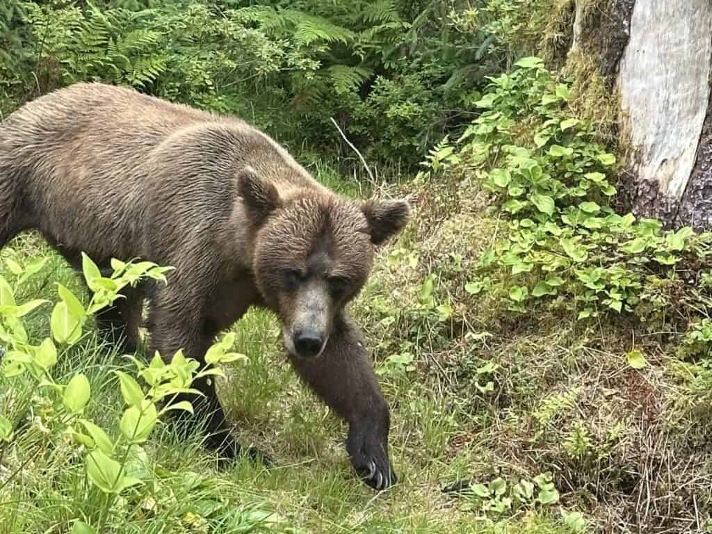
Anan Wildlife Observatory

Brown bear walking along the forest edge at Anan Wildlife Observatory near Wrangell, Alaska.
Distance
From Dock
35 Mi
Get
There by
Bears • Nature • Scenic
One of Alaska’s premier wildlife viewing destinations. Stand on an elevated wooden platform just feet above a roaring wilderness waterfall where brown and black bears gather to feast on migrating pink salmon.
View Map
Learn More
Hot Springs

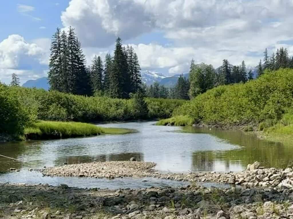
Chief Shakes Hot Springs

Slough leading to Chief Shakes Hot Springs on the Stikine River near Wrangell, Alaska.
Distance
From Dock
30 Mi
Get
There by
Forest • Peaceful • Relaxing
A natural geothermal oasis tucked deep inside the Stikine River wilderness. Soak in mineral hot spring waters sheltered by timber soaking tubs amidst lush old-growth rainforest.
View Map
Learn More
Cultural Landmark

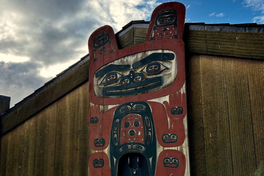
Chief Shakes Island

Front of Chief Shakes House in Wrangell, Alaska, with the carved house post displayed against the sky.
Distance
From Dock
.6 Mi
Get
There by
Culture • History • Totems
Step onto a historic islet in the heart of Wrangell Harbor to experience the living heritage of the Naanya.aayí clan. Chief Shakes Island preserves an authentic hand-adzed Tlingit tribal house surrounded by towering totem poles overlooking working docks.
View Map
Learn More
Glacier

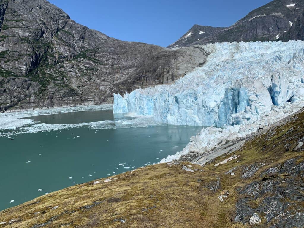
LeConte Glacier

LeConte Glacier near Wrangell, Alaska, with fresh ice from a recent calving event floating in the fjord.
Distance
From Dock
29 Mi
Get
There by
Nature • Scenic • Vistas
The southernmost active tidewater glacier in North America. Journey through a spectacular, iceberg-filled fjord to witness towering blue ice cliffs actively calving into the deep waters of LeConte Bay.
View Map
Learn More
Popular Trail

Long Lake Trail

Visitors walking on a wooden boardwalk on the Long Lake trail through Southeast Alaska rainforest
Distance
From Dock
28 Mi
Get
There by
Forest • Relaxing • Scenic
A true backcountry adventure on Wrangell Island’s southern road system. Climb up through hemlock slopes onto a high-elevation boardwalk that opens to a pristine wilderness lake ringed by granite ridges.
View Map
Learn More
Popular Trail

Mt. Dewey Trail

Two hikers walking up the forested Mt. Dewey Trail toward the overlook in Wrangell, Alaska.
Distance
From Dock
.4 Mi
Get
There by
Nature • Scenic • Vistas
Ascend through temperate rainforest along stepped timber boardwalks to a high observation platform overlooking Wrangell Harbor and Zimovia Strait. A rewarding, short-climb summit hike made famous by naturalist John Muir in 1879.
View Map
Explore Tours
Learn More
Recreation Area

Muskeg Meadows Golf Course

Scenic view from Muskeg Meadows Golf Course overlooking Eastern Passage and Wrangell Mountain in Wrangell, Alaska.
Distance
From Dock
2.5 Mi
Get
There by
Meadows • Recreation • Scenic
Experience one of the most uniquely Alaskan golf courses on earth—a 9-hole USGA-rated course carved right out of temperate rainforest and peat muskeg, complete with a local raven rule.
View Map
Learn More
Popular Trail

Nemo Saltwater Access Trail

View from the Turn Island Recreation Campsite at the end of the Nemo Saltwater Access Trail on Wrangell Island, Alaska.
Distance
From Dock
14 Mi
Get
There by
Nature • Peaceful • Scenic
Hike down through towering spruce and cedar forest to reach a secluded saltwater beach along Zimovia Strait. This hidden gem offers beachcombing, scenic picnic spots, and tranquil water views south of town.
View Map
Learn More
Historic Landmark

Petroglyph Beach Historic Park

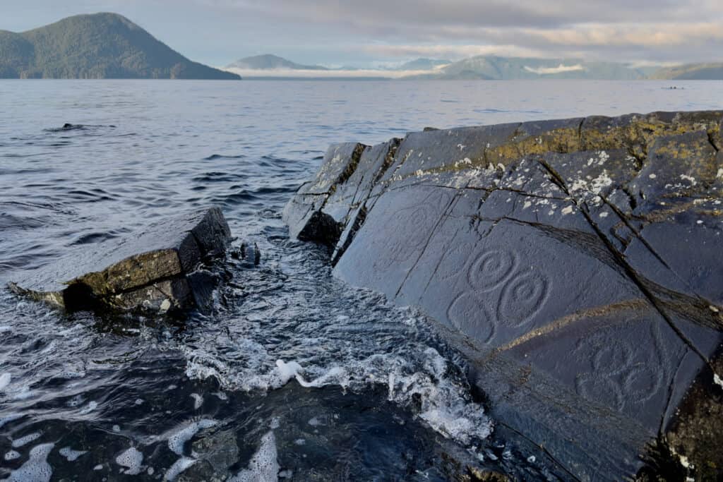
Ancient Tlingit petroglyphs carved into beach rocks in Wrangell, Alaska
Distance
From Dock
0.8 Mi
Get
There by
Culture • History • Scenic
Walk among ancient rock art pecked into dark metamorphic slate right at the edge of the Pacific Ocean. Located less than a mile from downtown Wrangell, this park offers a rare look at prehistoric Indigenous craftsmanship, beachcombing, and panoramic views across the Stikine Strait.
View Map
Explore Tours
Learn More
Popular Trail

Rainbow Falls Trail

Panoramic view from the Wrangell Falls trail overlooking Eastern Passage and the Stikine River Delta near Wrangell, Alaska.
Distance
From Dock
4.7 Mi
Get
There by
Nature • Scenic • Waterfall
Journey into deep temperate rainforest along a cascading creek that culminates in a dramatic waterfall observation deck. This signature Wrangell day hike delivers towering old-growth trees, lush ferns, and sweeping coastal views.
View Map
Learn More